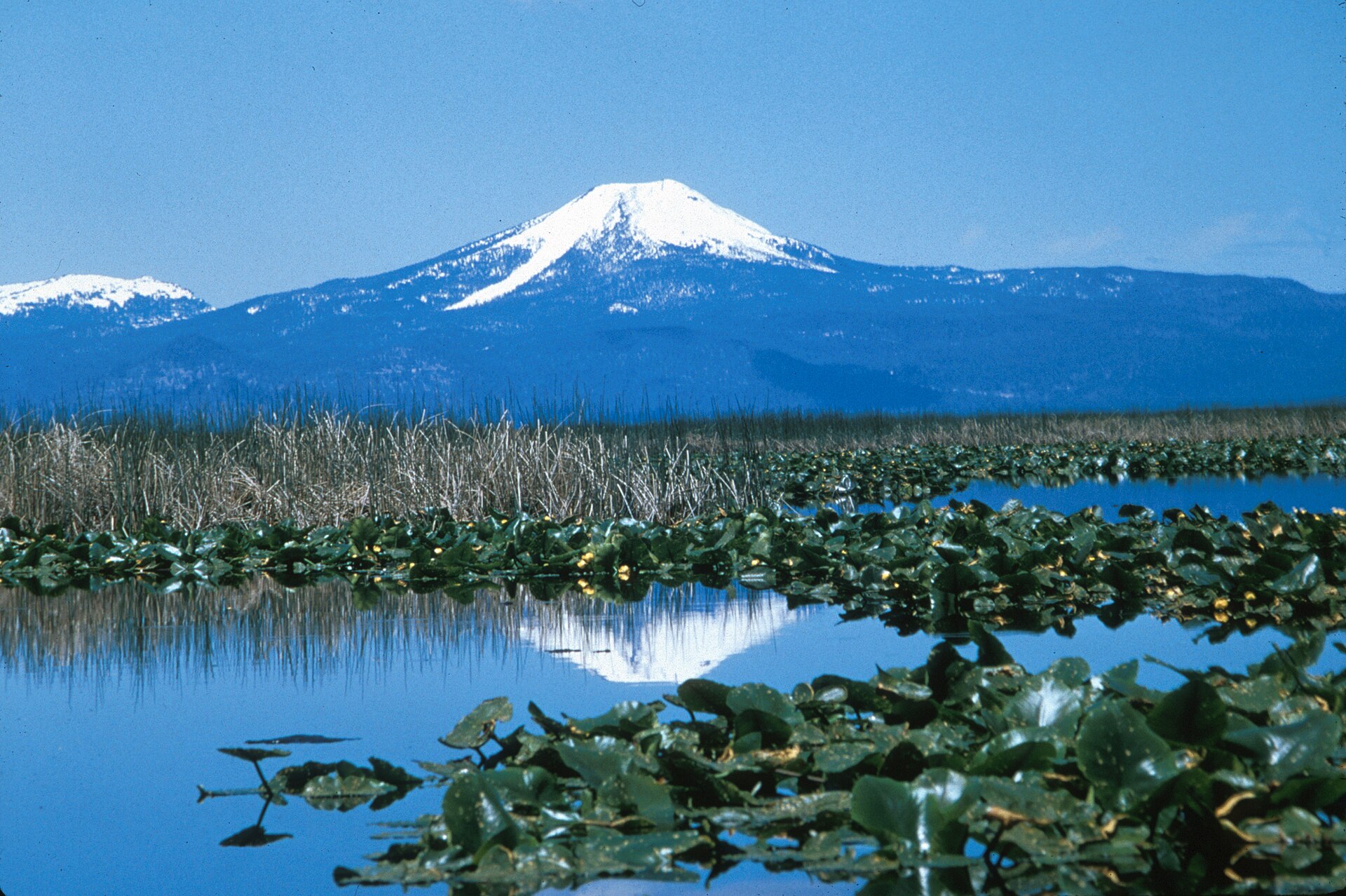
Mount McLoughlin reflecting across the tule marshes and calm waters of Upper Klamath National Wildlife Refuge
KLAMATH BASIN ARCHIVE • 42.2249° N, 121.7817° W • 4K AERIAL CINEMA

High Desert Drone Adventures

An archival field journal and 4K aerial expedition cataloging the forgotten landmarks, volcanic rims, pioneer waterways, and enduring local history of the Klamath Basin.

Aerial Cinema • Ultra HD Archive

4K Klamath Basin Flight Reels

Each flight is shot in 4K and paired with historical research, GPS telemetry, and written field dispatches—stream directly below or dive into the full YouTube archive.

All 4K Flights →
REEL KB-001 • Link River Canyon, Klamath Falls, OR 42.2235° N, 121.7942° W • 340 FT AGL 4K 60fps HDR
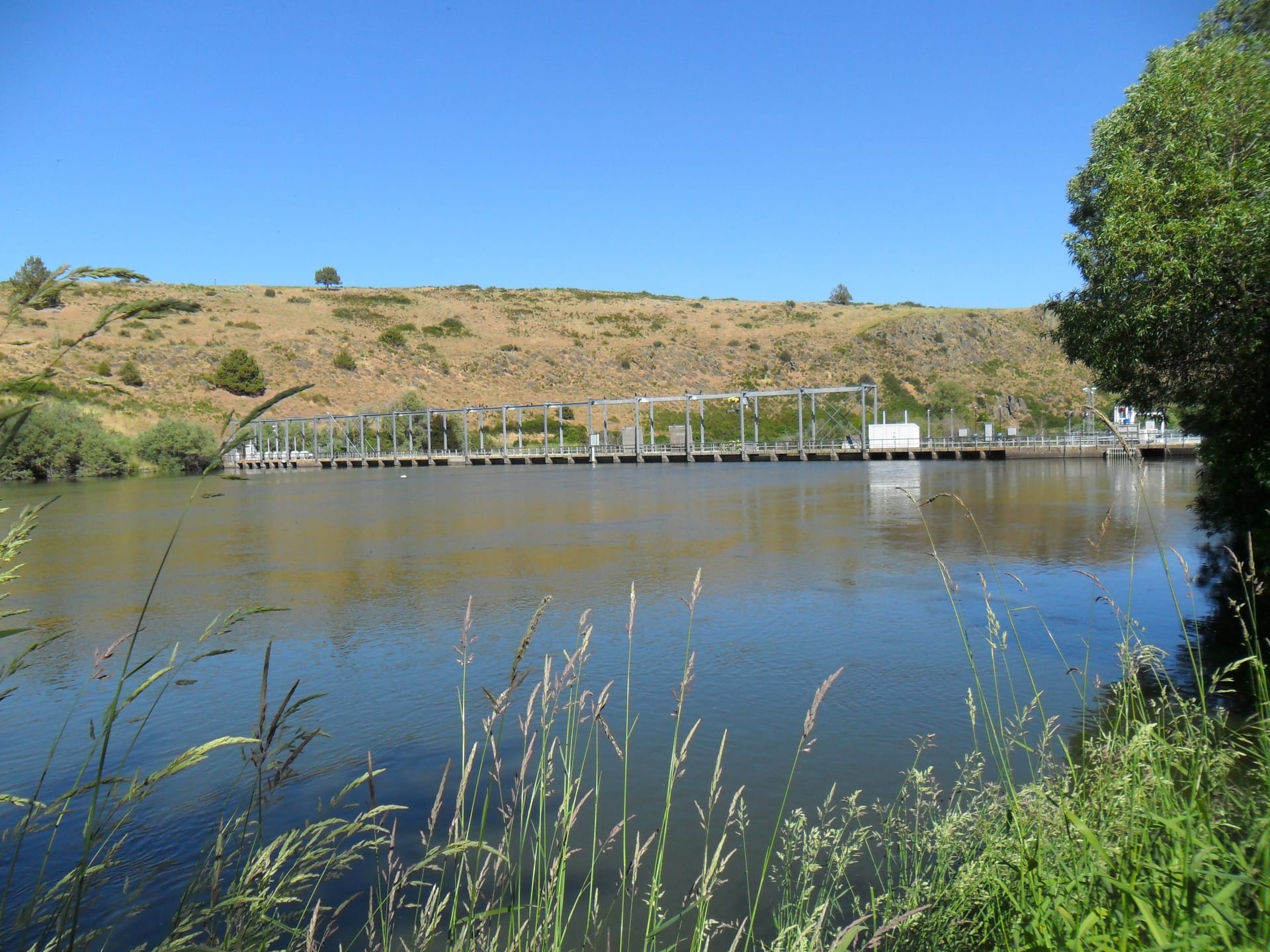
Link River at Golden Hour: The Shortest River That Built a Basin

Link River at Golden Hour: The Shortest River That Built a Basin

Tracing the 1.2-mile basalt corridor connecting Upper Klamath Lake to Lake Ewauna—site of Linkville’s founding, early canal works, and historic power flumes.

HISTORICAL ERA: 1867 – 1921 • RUNTIME 08:42
Select Aerial Flight Log (17 Cataloged Reels)
Field Journal • Local History Catalog

Latest Basin Dispatches

Written histories of Klamath County, Tulelake, and the Modoc Plateau—connecting archival records with contemporary aerial views of the land as it stands today.

View Complete Catalog (18) →
ENTRY KB-009 42.3917° N, 121.0433° W
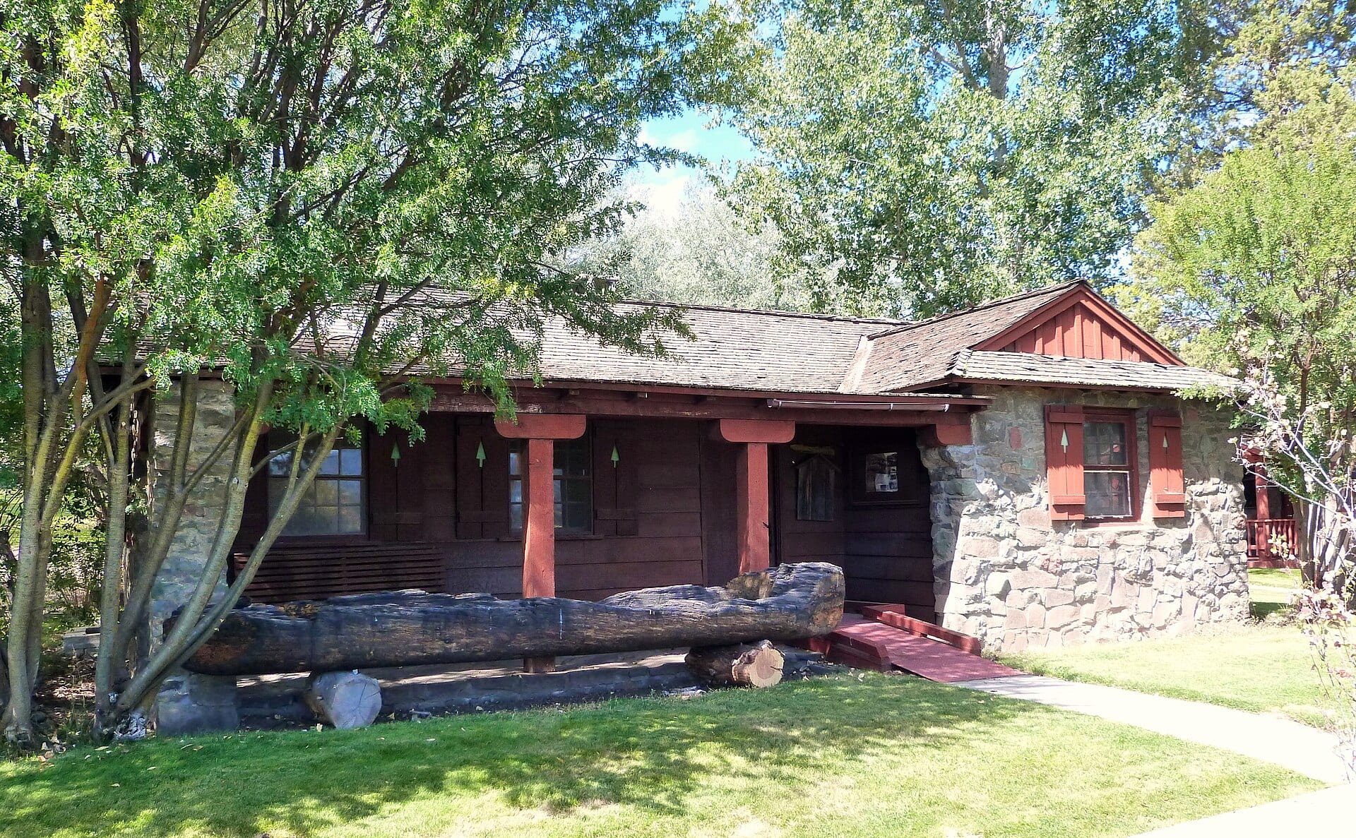
PLATE IX — Historic 1936 CCC-era Bly Ranger Station Office built of native basalt stone and timber in Bly, Oregon. ERA: 1870s – 1950s

Bly & the Sprague River Valley

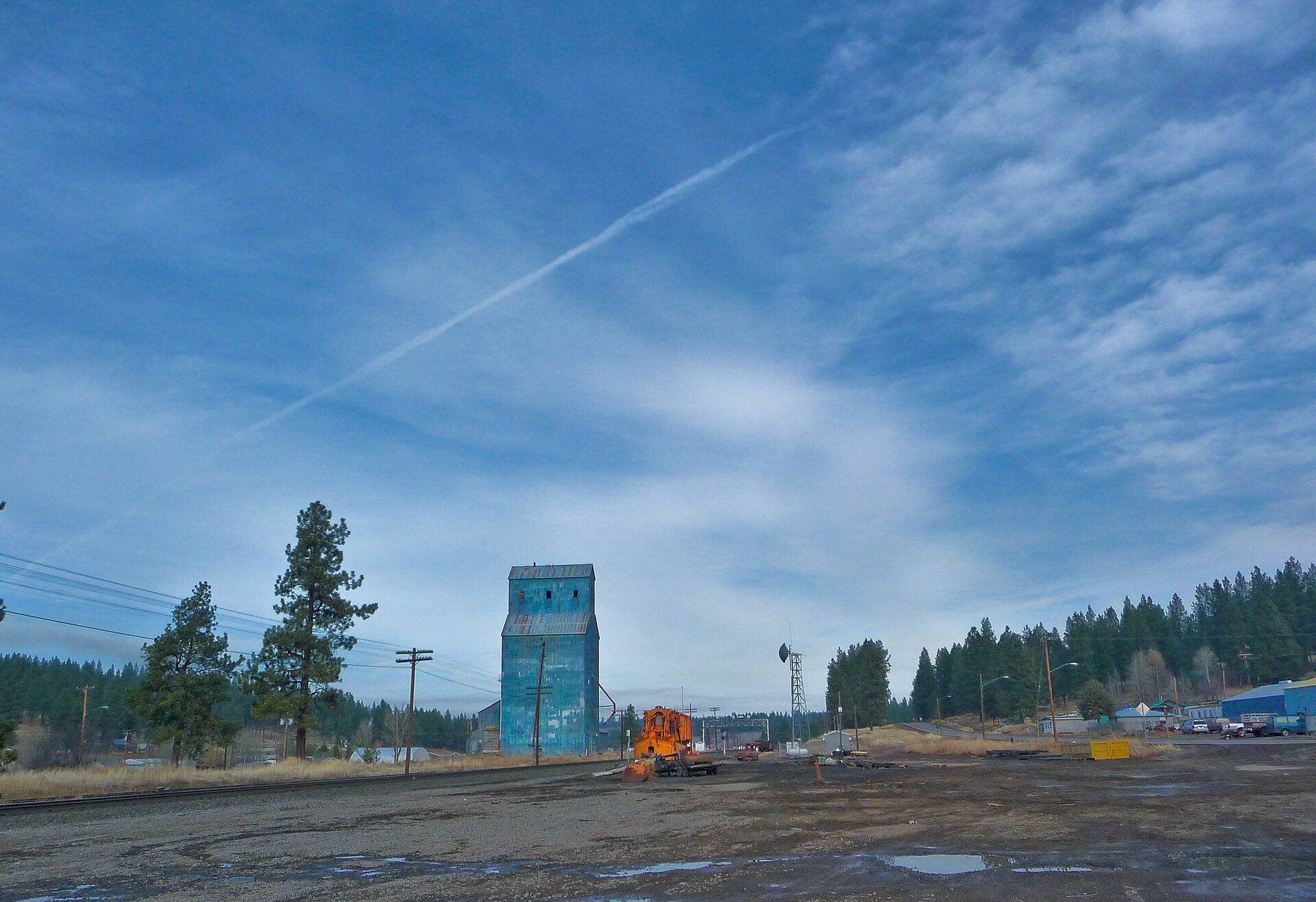
Set along the Sprague River at the foot of Gearhart Mountain, Bly evolved from a pioneer ranching outpost and OC&E railroad terminus into a historic logging hub—and the site of a somber World War II milestone.

ENTRY KB-018 42.6170° N, 121.3750° W
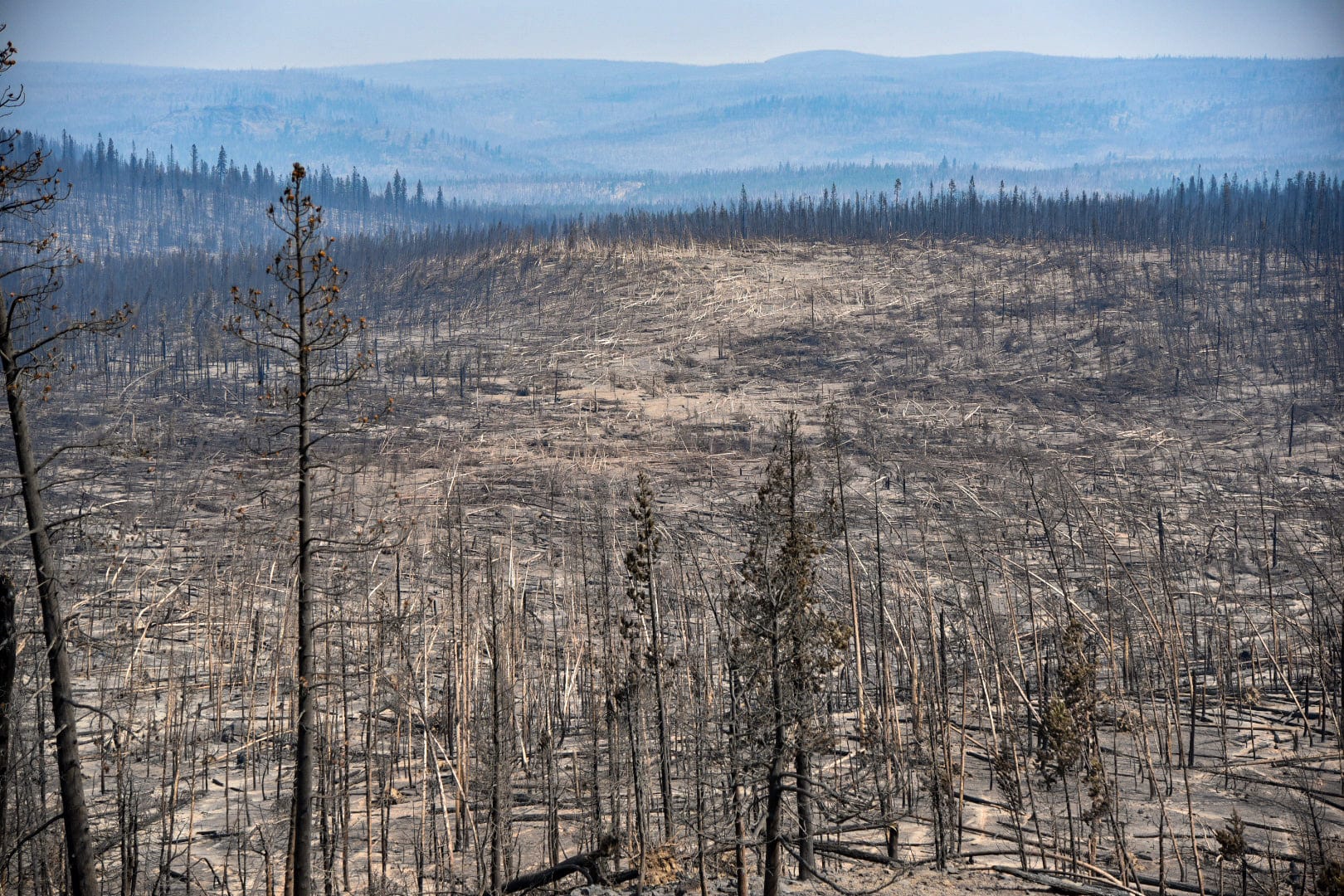
PLATE XVIII — Stark swath of toppled timber left by the July 18, 2021 fire tornado during the 413,765-acre Bootleg Fire in the Fremont-Winema National Forest. ERA: Ancestral – Modern Megafire Era

Wildland Fires in the Klamath Basin

Fire has always shaped the Klamath Basin's ponderosa pine forests and sagebrush steppe—from frequent low-intensity indigenous burns to a century of suppression and catastrophic 21st-century megafires like the Bootleg and Two Four Two fires.

USGS-Verified Survey Atlas • 18 Pinned Locations

Interactive Klamath Basin & Outback Map

Every pin marks a USGS GNIS-verified location from our field journal—from Lava Beds and Tule Lake north to Crater Lake and Gilchrist, and east to Fort Rock and the Alvord Desert. Toggle between Topographic and Aerial Satellite imagery or filter by historical theme.

Open Full Archive →
SHOWING 18 OF 18 USGS-VERIFIED SITES CLICK ANY SURVEY PIN FOR ARCHIVAL DISPATCH & TELEMETRY
Special Regional Feature • Timber & Rail

History of Logging in the Klamath Basin

For nearly a century, old-growth ponderosa pine powered the Klamath Basin—forging company towns, spanning hundreds of miles of logging railroads, and filling Lake Ewauna with floating timber booms.

Read Full Logging Archive →

After the Southern Pacific Railroad reached Klamath Falls in 1909, the basin’s vast yellow-pine plateau transformed overnight into one of the Pacific Northwest’s premier lumber engines. Massive operations—including Weyerhaeuser Timber Company, Pelican Bay Lumber, Ewauna Box, Chiloquin Lumber, and Gilchrist Timber Company—shaped the roads, railways, and town grids still visible from four hundred feet above the floor.

Today, aerial surveys along the OC&E Woods Line, Lake Ewauna’s submerged boom pilings, and historic mill sites connect modern viewers directly to the ox-drawn high wheels, steam jammers, and ponderosa sawmills preserved at Collier Memorial State Park.

Klamath Basin Timber Chronology

  • 1867 – 1900 Early Link River & Fort Creek water mills
  • 1909 Southern Pacific Rail opens national pine markets
  • 1929 Weyerhaeuser Klamath Falls mill & OC&E reaches Bly
  • 1938 Frank Gilchrist builds planned timber town on Hwy 97
  • Living Museum Collier Memorial State Park Logging Museum
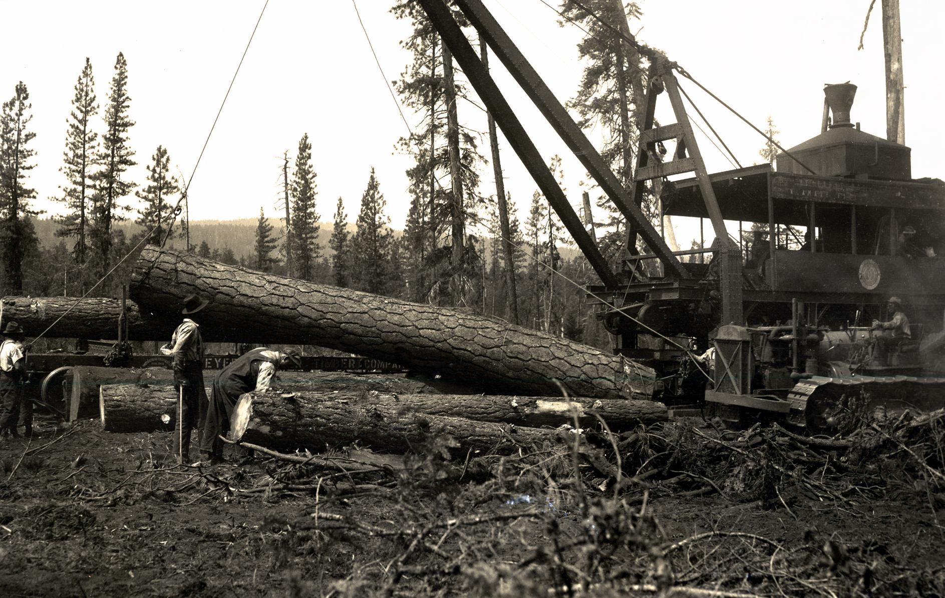
July 1930 Weyerhaeuser Timber Company steam loader hoisting ponderosa pine logs onto flatcars near Klamath Falls, Oregon
ARCHIVE PLATE — Weyerhaeuser Timber Co. steam loader hoisting old-growth ponderosa pine onto rail flatcars near Klamath Falls, July 1930. Photo: J. A. Beal / USDA Forest Service (Public Domain).
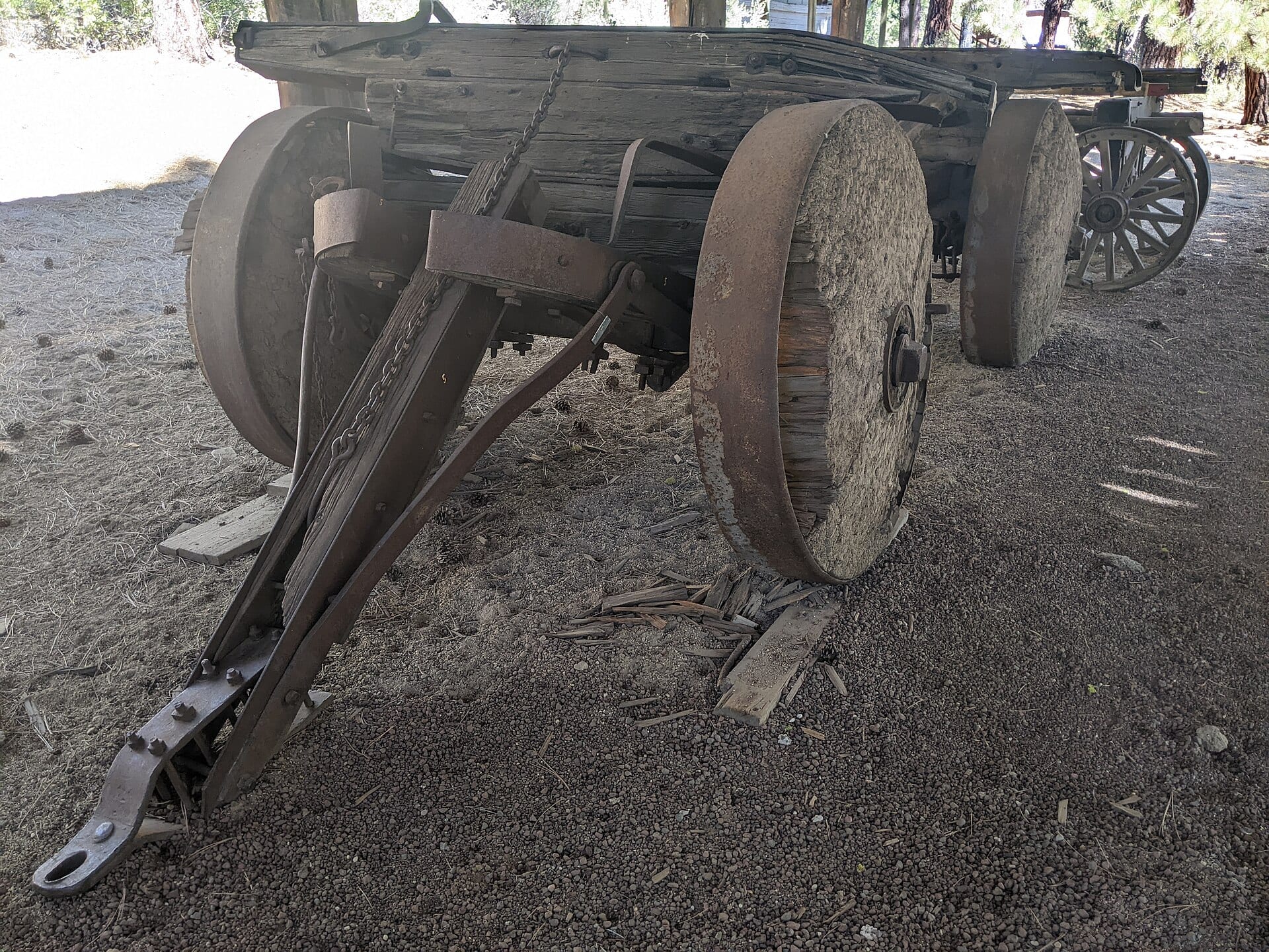
Historic solid-wheel ox-drawn log cart preserved at Collier Memorial State Park Logging Museum
FIELD ARTIFACT — Pioneer solid-wheel log cart preserved at Collier Memorial State Park Logging Museum north of Chiloquin. Photo: Bobjgalindo (CC BY 4.0).
Dedicated Ecological & Historical Report • Fire Ecology

Wildland Fires in the Klamath Basin

From millennia of indigenous cultural burning and 1930s CCC fire lookouts to modern megafires like the 413,765-acre Bootleg Fire—how wildfire continuously reshapes the Klamath Basin and Fremont-Winema forests.

Read Wildland Fire Dossier →
Stark swath of toppled timber left by the July 18, 2021 fire tornado during the Bootleg Fire in the Fremont-Winema National Forest
BOOTLEG FIRE RECORD — Blowdown swath carved by the confirmed July 18, 2021 fire tornado in the Fremont-Winema National Forest. Photo: U.S. Forest Service (Public Domain).
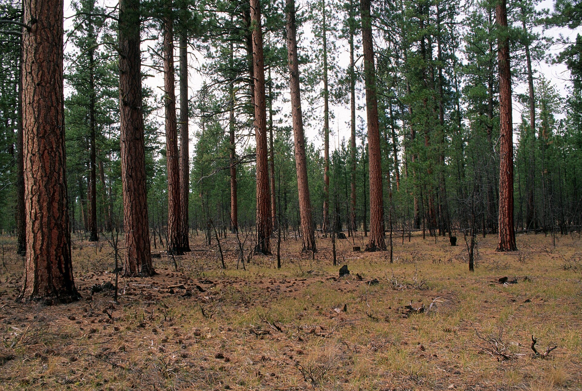
Open resilient ponderosa pine stand after prescribed fire treatment in the Fremont-Winema National Forest
RESTORATION CONTRAST — Open, fire-resilient ponderosa pine parkland following prescribed burning in the Fremont-Winema National Forest. Photo: USFS PNW Region (Public Domain).

Long before modern firefighting, frequent low-intensity lightning fires and deliberate cultural burning by the Klamath, Modoc, and Yahooskin peoples kept the basin’s ponderosa stands open and resilient. A century of full fire suppression built up dense understory fuels—setting the stage for unprecedented 21st-century wildfires during prolonged high-desert droughts.

From the 2020 Two Four Two Fire near Chiloquin to the monumental 2021 Bootleg Fire (413,765 acres stretching from Sprague River and Beatty toward Bly and Paisley), post-fire aerial surveys reveal both the raw power of modern megafires and the proven resilience of thinned, prescribed-fire-treated stands.

Klamath Basin Wildland Fire Ledger

  • Ancestral Era 5–15 yr low-intensity cultural & natural burns
  • 1930s CCC fire lookouts built across Fremont-Winema peaks
  • Sept 2020 Two Four Two Fire (14,400+ acres near Chiloquin)
  • July 2021 Bootleg Fire (413,765 acres • EF-1 fire tornado)
  • Present Day Tribal, USFS & ODF prescribed fire restoration
Explore ENTRY KB-018 →
FAA Wildfire Airspace Rule — “If You Fly, We Can’t”

Drones are strictly illegal near active wildfires and TFRs because they ground firefighting aircraft. All fire-scar and forest-recovery footage is filmed strictly after containment and official reopening.

Multi-Platform Discovery Hub

Follow the Flight Log Everywhere

This site is the central catalog for High Desert Drone Adventures—jump directly into 4K documentaries on YouTube, reels on Instagram, local stories on Facebook, or research threads on Reddit.

Community Field Tips • Klamath Basin & Outback

Suggest a Historic Site or Share Local Memory

Know a forgotten homestead, old timber spur, family story, or historic landmark we should research and film in 4K? File a field lead below.

POWERED BY CLOUDFLARE PAGES FUNCTIONS • PRIVACY-RESPECTING

About the Field Journal

Preserving High-Desert Memory Through Aerial Perspective

History looks different from four hundred feet above the sagebrush. Faint wagon ruts, old timber mill ponds, vanished shorelines, and volcanic fault lines reappear when the late-afternoon sun rakes across the Klamath Basin.

High Desert Drone Adventures pairs responsible aerial cinematography with careful historical cataloging—creating a permanent, searchable landing page for residents, historians, and travelers discovering southern Oregon and northern California.

Read the Field Guide →